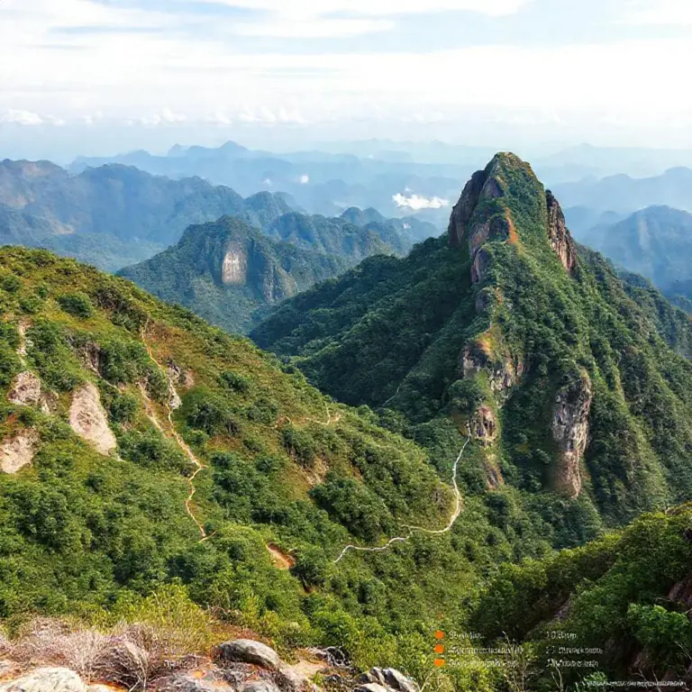
Step-by-step trail routes and difficulty levels for Pha Daeng, Pha Kuang, and Phanoi (maps, distances, elevation, estimated times)
- Step-by-step trail routes and difficulty levels for Pha Daeng, Pha Kuang, and Phanoi (maps, distances, elevation, estimated times)
Welcome, intrepid travelers, to the spiritual and natural heart of Laos! Luang Prabang, a UNESCO World Heritage site, is not just about gilded temples and serene alms rounds; it’s a gateway to some of Southeast Asia’s most rewarding, yet often underestimated, mountain treks. This comprehensive guide details the Step-by-step trail routes and difficulty levels for Pha Daeng, Pha Kuang, and Phanoi, ensuring your Laos tourism hiking adventure is safe, prepared, and unforgettable. We dive deep into the maps, distances, elevation gains, and estimated hiking times for these three iconic peaks surrounding the city.
Understanding the Luang Prabang Hiking Triangle
The three peaks—Pha Daeng, Pha Kuang, and Phanoi—offer a spectrum of challenges, perfect for hikers ranging from casual walkers to seasoned trekkers. While Pha Kuang is most famous for its stunning waterfalls, Pha Daeng and Phanoi are less frequented, offering superior solitude and panoramic views of the Nam Khan and Mekong Rivers. Before setting out, always confirm local conditions and hire a registered local guide where necessary, demonstrating responsible Laos tourism practices.
Trail 1: Pha Kuang Waterfalls & Summit Challenge
Pha Kuang (often confused with Kuang Si Falls, which is much further out) is a highly accessible trek, often combined with a visit to the famous cascade. The trail to the summit is often unmarked from the main tourist area, requiring local knowledge.
Route Overview & Difficulty
Distance (Return): Approx. 6–8 km (depending on starting point) |
Elevation Gain: Approx. 350m |
Estimated Time: 3–4 hours (Round Trip)
Step-by-Step Trail Route for Pha Kuang Summit
- Start Point: Begin near the main ticket office/entrance area for Kuang Si Falls. Look for the small, often overgrown path heading uphill away from the main pool area (ask a local guide for the precise trailhead).
- Initial Ascent: The first 45 minutes involve a steep, rugged climb through dense secondary forest. Expect slippery mud, especially in the rainy season (May–October).
- Ridge Navigation: The trail levels slightly as you approach the main ridge line. Keep an eye out for clear blue or white trail markers painted on rocks or trees.
- Summit Push: The final 30 minutes are steep again, often involving scrambling over exposed roots. The top offers breathtaking views over the surrounding jungle canopy.
- Descent: Due to the steepness, descending the same route requires careful footing. Consider doing a loop if you have a guide who knows the connection trail back toward the main road, though the out-and-back is safer for solo hikers.
Trail 2: Pha Daeng – The Red Cliff Experience
Pha Daeng (Red Cliff) offers perhaps the most dramatic views directly over Luang Prabang city and the confluence of the two rivers. This hike is significantly more challenging and remote than Pha Kuang, demanding respect for the terrain. Mastering the Step-by-step trail routes and difficulty levels for Pha Daeng is key to a successful trek.
Route Overview & Difficulty
Distance (Return): Approx. 10–12 km |
Elevation Gain: Approx. 600m |
Estimated Time: 6–8 hours (Round Trip)
Step-by-Step Trail Route for Pha Daeng
Map Note: Due to the remoteness, detailed, publicly available GPS maps are rare. A local guide is highly recommended for navigation and safety.
- Access: Trails often begin in villages north/west of the city center, requiring a short motorbike or tuk-tuk ride to the trailhead.
- The Valley Floor: The initial section usually traverses rice paddies or low-lying agricultural land, which can be extremely muddy or flooded seasonally.
- The Climb Begins: Once the true incline starts, expect relentless uphill hiking through dry, dense forest. The path can be faint, marked only by occasional stacked stones (cairns).
- Water Management: Water sources are scarce on the upper slopes. Carry ample supplies (at least 3 liters per person).
- The Cliff Face: The final approach to the cliff edge involves navigating loose scree and exposed rock faces. Be extremely cautious near the edge; the drop-off is severe.
- Reward: The panoramic view of Luang Prabang laid out below is the unparalleled reward for conquering this difficult ascent.
Trail 3: Phanoi Mountain – The Local Favorite
Phanoi Mountain is a popular spot for locals seeking exercise, often accessed via well-trodden paths starting closer to the city’s edge. While shorter than Pha Daeng, its consistent steepness makes it a solid workout.
Route Overview & Difficulty
Distance (Return): Approx. 5–6 km |
Elevation Gain: Approx. 400m |
Estimated Time: 3.5–5 hours (Round Trip)
Step-by-Step Trail Route for Phanoi
For those interested in a visually engaging experience, check out this video showcasing the natural beauty you can expect on these Laotian trails:
- Trailhead Location: The main trailhead is often found on the western side of Luang Prabang, sometimes requiring a short ride past the airport area.
- The Staircase Section: The initial part of the Phanoi trail often incorporates rudimentary wooden steps or carved-out earth stairs, making the first 1 km very vertical.
- Mid-Section Traverse: The path settles into a steady, switch-backed climb. This section is generally well-maintained due to local use, making navigation straightforward.
- Rest Stops: Several small clearings or platforms exist where local vendors sometimes set up refreshments on busy weekends.
- Summit Viewpoint: The top offers a fantastic, unobstructed view, often considered the best sunrise spot near the city, perfect for photography during your Laos tourism visit.
- Descent: Because of the consistent steepness, descending requires strong knees. Take frequent breaks to avoid slipping.
Explore detailed topographic maps of the Luang Prabang region here.
Essential Preparation for Laos Hiking
Regardless of which trail you choose, proper preparation is non-negotiable. Understanding the terrain and timing is crucial for safe Laos tourism. Here is a summary table to compare the routes:
| Trail | Primary Focus | Est. Time (RT) | Difficulty | Local Guide Needed? |
|---|---|---|---|---|
| Pha Kuang | Waterfalls & Summit | 3–4 Hours | Moderate | Recommended |
| Pha Daeng | Panoramic Views | 6–8 Hours | Strenuous | Essential |
| Phanoi | Consistent Workout | 3.5–5 Hours | Intermediate | Optional |
Checklist for the Trails
- Footwear: Sturdy hiking boots with excellent ankle support.
- Hydration: Minimum 2-3 liters of water per person, especially for Pha Daeng.
- Navigation: Download offline maps (like Maps.me) or rely on your guide.
- Weather Gear: Lightweight rain jacket (even in the dry season).
- Safety: Basic first-aid kit including blister treatment.
คำถามที่พบบ่อย (FAQ)
Q1: Is it safe to hike Pha Daeng without a guide?
A: For Pha Daeng, it is strongly discouraged. The trail is remote, poorly marked, and navigating the final approach to the cliff edge requires local knowledge to ensure safety. For Pha Kuang and Phanoi, a guide is optional but recommended if you are unfamiliar with the region.
Q2: What is the best time of year to attempt these trails?
A: The cool, dry season (November to February) offers the most comfortable temperatures and stable trail conditions. Avoid peak rainy season (July–September) when trails become extremely slippery and potentially hazardous.
Q3: Are there entrance fees for the Pha Daeng or Phanoi trails?
A: Unlike Kuang Si Falls, Pha Daeng and Phanoi generally do not have formal, centralized entrance fees for the hiking paths themselves. However, you may incur costs for transport to the trailhead or fees paid directly to local village guides or gatekeepers.
Q4: How does the elevation gain affect the difficulty level?
A: Elevation gain is the primary factor. While Phanoi has a similar gain to Pha Kuang’s summit, Phanoi’s climb is more consistent and steep. Pha Daeng’s significant distance combined with its 600m gain makes it the most strenuous, requiring excellent cardiovascular fitness.
Q5: Can I see the sunset from Pha Daeng?
A: While the view is spectacular, descending Pha Daeng after sunset is dangerous due to the lack of lighting and difficult terrain. It is highly recommended to complete the descent well before dusk (aim to start descending by 2:00 PM if starting at 8:00 AM).
References
- Nong Khiaw Viewpoints Hike Guide: Complete Route, Safety Tips, and Best Photo Spots for Pha Daeng, Pha Kuang, and Phanoi
- Best time to hike Nong Khiaw viewpoints and how to plan your day (weather, permits, guided vs self-guided)
- Safety, gear, and navigation tips for Nong Khiaw hikes (footwear, water, trail markers, local guides, emergency contacts)